Log in
All resources
Create a design
29 Free Artworks of Old Maps Of Candia
bibliothèque nationale de france
marco boschini
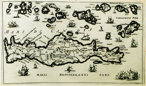
old maps of crete
old maps of heraklion
17th-century maps of crete
maps of ports and fortresses of the mediterranean by marco boschini (1651)
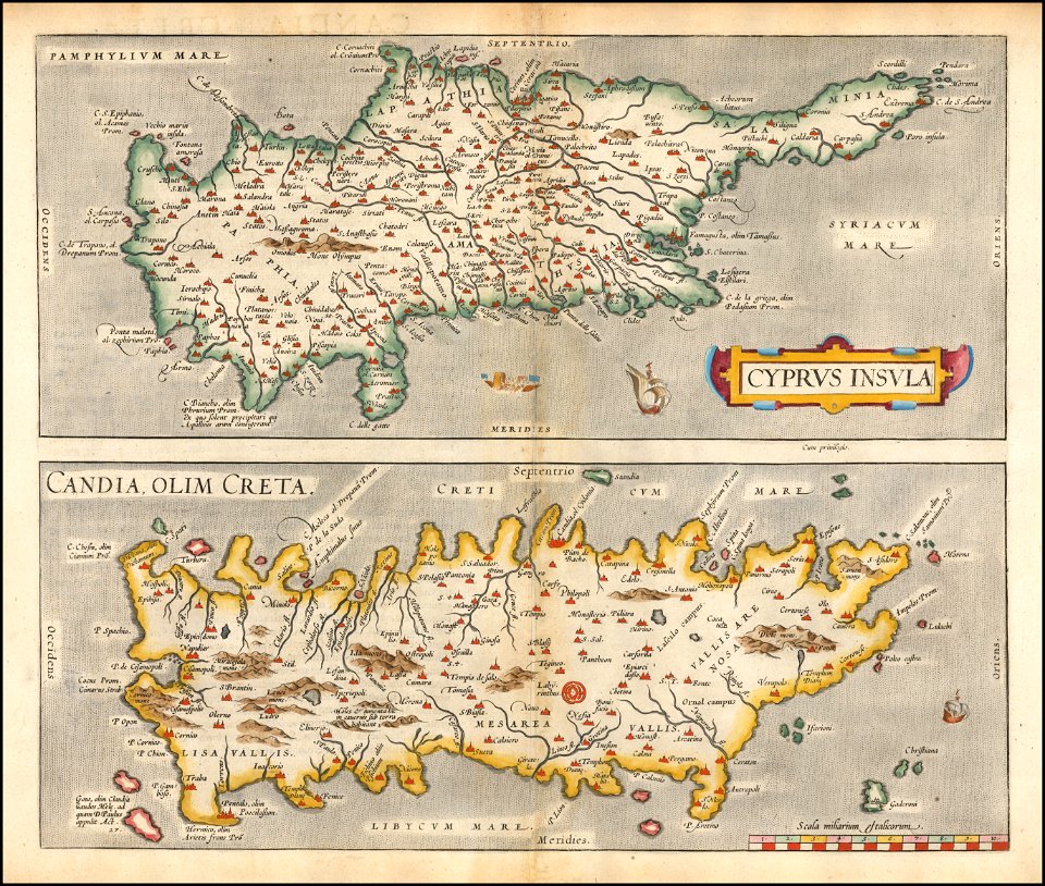
maps by abraham ortelius
siege of candia
historical images of greece
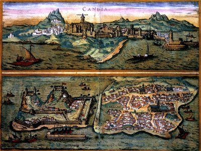
il regno tutto di candia
maps by abraham ortelius
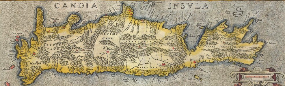
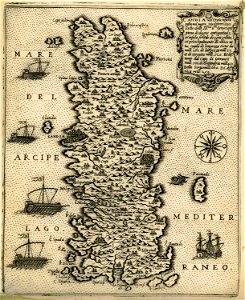
old maps of crete
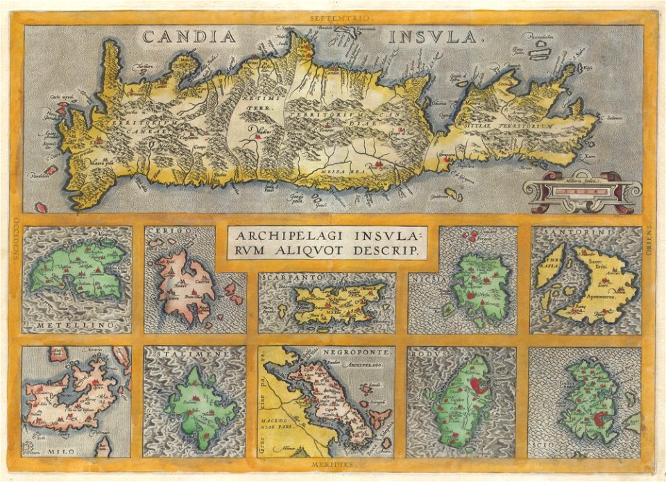
old maps of greece
old maps of crete
old maps of greece
old maps of crete
description des principales villes (1690)
old maps of crete
description des principales villes (1690)
old maps of crete
old maps of crete
giovanni camocio
maps with cartouches
old maps of crete
prints from manesson travaux de mars at the peace palace library
artillery of the ottoman empire
maps and topographical views by joris hoefnagel
crete under venetian rule
maps of the sea of marmara
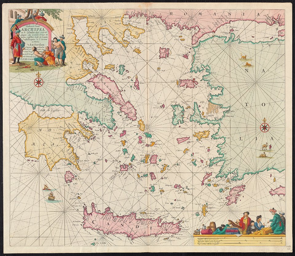
old maps of the aegean sea
heraklion venetian walls
1651 in candia
old maps of chania
1651 in chania
old maps of heraklion
marco boschini
old maps of heraklion
baroque
17th-century maps of crete
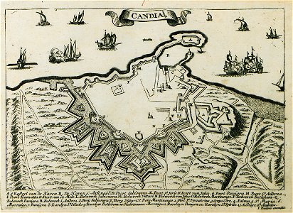
old maps of candia
17th-century maps of crete
old maps of candia
flemish prints in the british museum
coenraed lauwers
old maps of chania
1651 in chania
17th-century maps of crete
old maps of candia
16th-century maps of crete
old maps of candia
16th-century maps of crete
old maps of candia
16th-century maps of crete
old maps of candia
korte beschryvinghe (1686)
old maps of heraklion
maps of ports and fortresses of the mediterranean by marco boschini (1651)
old maps of heraklion
kurtze beschreibung von republick venedig
chania in the 1680s
maps of ports and fortresses of the mediterranean by marco boschini (1651)
old maps of heraklion
maps of ports and fortresses of the mediterranean by marco boschini (1651)
old maps of gavdos
maps of ports and fortresses of the mediterranean by marco boschini (1651)
old maps of souda (crete)
1640s maps of greece
marco boschini
1 - 29 of 29
/ 1


![Port and Forte[z]za d[ell]a Suda / by Marco Boschini, Marco Boschini, 1651](https://cdn.creazilla.com/illustrations/10001359456/port-and-fortezza-della-suda-by-marco-boschini-marco-boschini-1651-sm.webp)
